Albert Park
1020 12th Street
Albert Park is located at 1020 12th Street East. The park was once the schoolyard for Albert School, which is now the Albert Community Centre. Both the Community Centre and the park are named after Albert, husband of Queen Victoria. Some sources also say they were named after former School Board chair Albert J. Sparling, The school closed in 1978. In 1983, it was designated a municipal heritage site and underwent renovations to become a community centre. At that time, renovations also began to repurpose the schoolyard into a park. On October 20, 1985, both the park and community centre officially opened. Albert Park consists of walking paths, two tennis courts, benches, picnic area, bike racks, and playground equipment. If you would like to reserve a tennis court, please call the Leisure Services Division at 1-306-975-3366.
This is the second Albert Park in Saskatoon’s history. The first park was developed in the 1930s in the Haultain neighbourhood on Albert Avenue and Taylor Street. The park was later renamed after Parks Board member W.W. Ashley.
This information was gathered from the following sources:
– COS Archives. Albert School Essay. (MHAC, 1983), p. 4.
– COS Archives 1101-006. “Albert School Back in Service”. Star Phoenix, 1985.
Cumberland Park
1415 8th Street
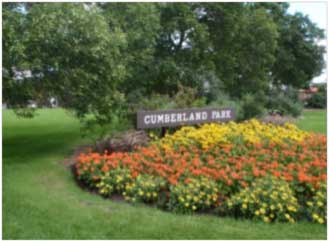
Cumberland Park is located at 1415 8th Street East. It is situated on 3.3 acres of land on the corner of Cumberland Avenue and 8th Street East. The park has several benches and is often used for recreational activities.
President Murray Park
1205 Colony Street

President Murray Park is situated on 7.3 acres of land in the Varsity View neighbourhood. It is bounded by Colony Street to the south, McKinnon Avenue to the west, Wiggins Avenue to the east, and Aird Street to the north.
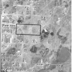
In 1928, City Council decided to set aside this land and use it for park and athletic purposes. At this time, the City owned 47 of the 80 lots that comprised the area. The remaining 33 lots were undeveloped private properties. Some of the property owners lived in Saskatoon, while some were from the United States, Australia, and the United Kingdom. As a result, the process for the City to acquire this land was quite complicated.
The City entered into negotiations with private landowners to acquire the remaining 33 lots. These negotiations lasted through 1928 and 1929. Other lots in the neighbourhood were offered in trade, but these offers were rescinded when City administration determined it needed to sell the lots in question to pay for sewer and water development in the neighbourhood. The last properties were acquired on May 5, 1931.
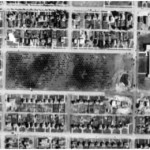
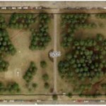
Originally, the City neglected to close Munroe Avenue, which at that time ran through the middle of the park. In the 1950s, the City closed this portion of Munroe Avenue and replaced it with a path going through the middle of the park. However, there continued to be problems with people driving through the park on this path. A 1962 report recommended this path be closed, but the path still exists today. Street and lane closures were not done until 1942 and lot lanes were not cancelled until 1960.
While there were early plans for football fields, baseball diamonds, tennis courts, and other sporting facilities, these plans never came to fruition. No landscaping or planting occurred until 1942, when 1100 spruce trees were planted and a barbed wire fence was erected around the entire park. Prior to 1942, the area was used for gardening purposes where the City rented vacant lots out to people to use for gardening. In December of 1942, it was noted that 21 spruce trees had their tops broken off. This led to the Principle of Albert School agreeing to talk to the children about the importance of letting the trees grow. That year, the Parks Board also requested there be “special supervision” of the park during the week prior to Christmas due to the “shortage of Christmas trees”. In 1953, residents explained that the condition of the park was “unsightly” and that the park was not safe due to the lack of lighting. Improvements such as landscaping and the addition of playground equipment were suggested. In 1954, City Council created a committee that recommended trees be removed to make way for paths, that the park be lit, that tree branches be trimmed to open up sightlines, and that shrubs be planted to create an “open, well-lighted effect”. In 1962, some spruce trees were removed and were to be replaced by shade trees.
This information was gathered from the following source:
– City Archivist, Jeff O’Brien.
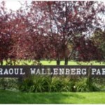
Raoul Wallenberg Park
710 Munroe Avenue
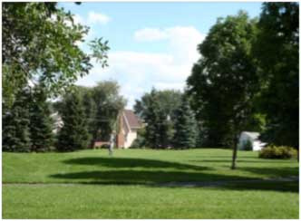
The park is located at 710 Munroe Avenue behind Congregation Agudas Israel. The western boundary of the park is shared with Congregation Agudas Israel on MacKinnon Avenue.
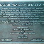
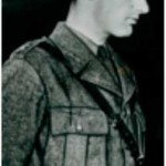
The park was originally named Elks Park, after the Benevolent and Protective Order of Elks Saskatoon Lodge. However, the park name was changed by Mayor Clifford Emerson Wright when he granted the wish of the Jewish Community to have the park named after Raoul Wallenberg. Raoul Wallenberg was a Swedish diplomat who saved the lives of hundreds of thousands of Jews during the Holocaust. On December 10, 1985, Raoul was recognized by the House of Commons for his humanitarian efforts and was made an honourary citizen of Canada.